
Roof inspections without the guesswork.
Sharp aerial imagery and clear, contractor-ready reporting—without scaffolding for the initial visual assessment.
See what is happening before deciding what happens next.
We inspect visible roof areas from the air and capture the detail that is difficult—or unsafe—to see from the ground. You receive organised photographic evidence, with structured findings and practical recommendations available in the Premium Survey.
It is a fast, non-invasive way to understand visible roof condition and brief a competent roofing contractor with confidence.
See how it works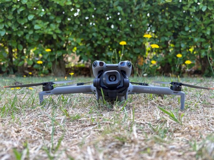
Roof inspections and 2D aerial mapping.
Every flight is planned around your project, the site, local airspace and suitable weather.
Roof condition surveys
A broad visual review of accessible roof areas, including coverings, ridges, valleys, chimneys, leadwork and gutters.
Leak investigation
Targeted imagery of likely water-ingress points such as slipped tiles, damaged flashings, valleys and roof junctions.
Contractor-ready reports
Numbered photographs, clearly described visible findings and sensible next steps that make contractor conversations easier.
2D aerial mapping
Detailed overhead maps of fields, properties and sites, created from overlapping aerial photographs. Explore our mapping service.
See your land as one clear picture.
We combine overlapping drone photographs into a detailed overhead map, known as an orthomosaic. It gives you a current visual record of your land or site, with far more context than individual photographs.
Farms & fields
See field layouts, tracks, access points, buildings and visible land features together. Useful for planning work, keeping records and discussing projects with contractors.
Properties & estates
Get an overall view of larger properties, grounds and land parcels to support maintenance planning, site discussions and a clear record of existing conditions.
Construction & site progress
Document the layout and visible progress of a site. Repeat mapping visits can provide a visual record of changes over time.
A map you can put to use
Your map is supplied digitally, with image or PDF delivery and other mapping formats agreed before the survey. Indicative distance and area measurements can be included where suitable for the project.
Mapping is quoted individually based on the area, site access and required outputs. Flight suitability, permissions and weather are assessed before booking. Maps support visual planning and records; they do not establish legal boundaries or replace a measured land survey.
From first concern to clear evidence.
No jargon-heavy theatre. Tell us what you need to understand, and we will recommend the right level of inspection.
Tell us the issue
Share the property location and what you are concerned about.
We plan the flight
Weather, airspace, surrounding people and property are assessed before take-off.
We capture the detail
High-resolution imagery is collected safely from useful angles.
You receive the evidence
Images—and, where selected, a structured report—are supplied digitally.
Choose the level of detail you need.
Packages cover residential properties up to four bedrooms. Larger, complex or commercial roofs are quoted individually.
A clear aerial overview for a general visual check.
- 20–30 high-resolution photographs
- Main accessible roof areas
- Digital image delivery
A closer inspection of the important roof details.
- 30–60 high-resolution photographs
- Coverings, ridges and chimneys
- Leadwork, flashings and gutters
Detailed evidence with a clear report for the next step.
- Everything in the Standard Survey
- Aerial video
- Structured findings and priorities
- Practical contractor recommendations
Every package includes a site-specific risk assessment, airspace checks and any required ATC coordination or permissions. Flights are weather-dependent and may be rescheduled in rain, high winds or poor visibility. Surveys are visual and non-invasive; they are not structural surveys.
Guernsey based. Carefully planned.
Island weather, controlled airspace and close-built residential areas all shape how a safe drone inspection is planned. Every survey is assessed individually, with straightforward communication from the first enquiry to delivery.
What our clients say.
Real feedback from a Guernsey roof survey client.
“We at Healthcare Group are very happy with Guernsey Drone Surveys services from start to finish. The Premium Survey, images and comprehensive final report were key in identifying the site of the damage. We forwarded the report to the roofer who could then make the repair with a clear indication of where the roof was damaged and repair the loose roof tiles, fixing the leak.”
Had a survey with us? We welcome honest feedback and will check with you before publishing your comments or name.
Share your feedbackBefore we fly.
Do I need scaffolding first?
No. A drone survey can provide the initial visual evidence without scaffolding. Physical access may still be recommended if a contractor needs to investigate or complete repairs.
Can you identify the cause of a leak?
We can focus on likely external ingress points and document visible defects. Some leaks require further hands-on investigation because water can travel before appearing inside.
What happens if the weather is unsuitable?
We will rearrange the flight. Rain, high winds and poor visibility can affect safety and image quality, so suitable conditions come first.
How quickly will I receive the images?
Delivery timing is confirmed when you book and depends on the selected package and inspection complexity. We keep the process clear from the outset.
Tell us about your property or mapping project.
Share the location and what you need, and we will recommend a roof survey package or provide a quote for 2D mapping. We will also confirm a suitable-weather window for the flight.
Prefer email? Write to guernseydronesurveys@gmail.com
Survey enquiry
Fields marked as required must be completed.